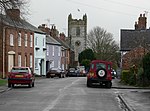
Bruntingthorpe
Civil parishes in Harborough DistrictLeicestershire geography stubsUse British English from July 2015Villages in Leicestershire

Bruntingthorpe is a village and civil parish in the Harborough district of Leicestershire, England. According to the census in 2001 the parish had a population of 398. The parish also includes the hamlet of Upper Bruntingthorpe. The population at the 2011 census had increased to 425. the village contains a pub called the plough, a restaurant called the joiners and a garage called bruntingthorpe motor engineers.The former RAF Bruntingthorpe is now Bruntingthorpe Aerodrome.
Excerpt from the Wikipedia article Bruntingthorpe (License: CC BY-SA 3.0, Authors, Images).Bruntingthorpe
Church Walk, Harborough Bruntingthorpe
Geographical coordinates (GPS) Address Nearby Places Show on map
Geographical coordinates (GPS)
| Latitude | Longitude |
|---|---|
| N 52.50279 ° | E -1.11457 ° |
Address
Church Walk
Church Walk
LE17 5QH Harborough, Bruntingthorpe
England, United Kingdom
Open on Google Maps


