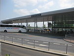
Kingston, Milton Keynes
Kingston is a district in the east side of Milton Keynes, in the civil parish of Kents Hill, Monkston and Brinklow. Kingston District Centre is a large retail development that serves this side of the Milton Keynes urban area (its home parish and the parishes of Broughton, Milton Keynes (civil parish), Walton, Woburn Sands and Wavendon). The District Centre houses a Tesco hypermarket and other UK high street names, such as Aldi, Boots, Wilko, and other retail outlets. The centre also has a small local library, a meeting place and a separate restaurant building on the Southern ring road. Its Marks and Spencer closed in February 2020According to Milton Keynes City Council, Kingston, Wolverton, Bletchley and Westcroft form the second tier in the retail hierarchy of the city, below Central Milton Keynes.Bounded by Chaffron Way (H7) to the north, Tongwell St (A4146/V11) to the east, Standing Way (A421/H8) to the south and Newport Rd (formerly the A5130) to the east, the rest of the district consists of motor dealers, light industry factories and warehouses, including a Costco wholesale.
Excerpt from the Wikipedia article Kingston, Milton Keynes (License: CC BY-SA 3.0, Authors).Kingston, Milton Keynes
Chippenham Drive, Milton Keynes Kingston
Geographical coordinates (GPS) Address Nearby Places Show on map
Geographical coordinates (GPS)
| Latitude | Longitude |
|---|---|
| N 52.0372 ° | E -0.6855 ° |
Address
Chippenham Drive
MK10 0AQ Milton Keynes, Kingston
England, United Kingdom
Open on Google Maps


