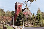
Elmers End
Districts of the London Borough of Bromley

Elmers End is an area of south-east London, England, within the London Borough of Bromley and the historic county of Kent. It is located south of Beckenham, west of Eden Park, north of Monks Orchard and east of Anerley.
Excerpt from the Wikipedia article Elmers End (License: CC BY-SA 3.0, Authors, Images).Elmers End
Elmers End Road, London Elmers End (London Borough of Bromley)
Geographical coordinates (GPS) Address Nearby Places Show on map
Geographical coordinates (GPS)
| Latitude | Longitude |
|---|---|
| N 51.3971 ° | E -0.0525 ° |
Address
Goals
Elmers End Road
BR3 4EJ London, Elmers End (London Borough of Bromley)
England, United Kingdom
Open on Google Maps


