Strixton
Civil parishes in NorthamptonshireNorth NorthamptonshireNorthamptonshire geography stubsUse British English from March 2014Villages in Northamptonshire

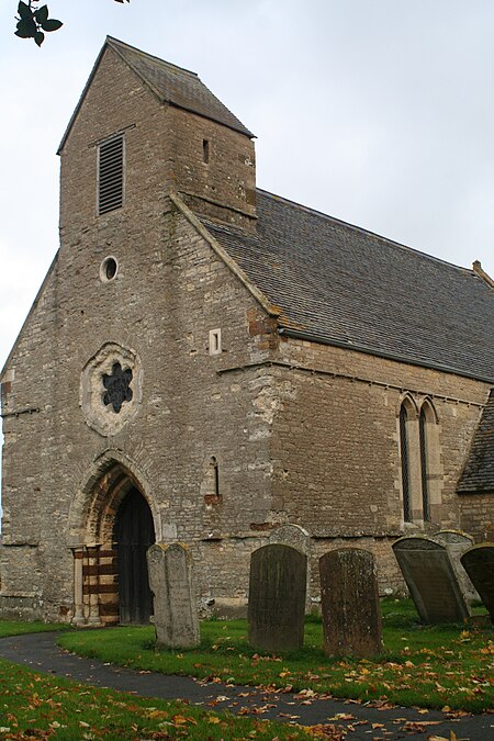
Strixton is a small village in eastern Northamptonshire that borders the main A509 road between Wellingborough and Milton Keynes. The population of the village remained less than 100 at the 2011 Census and is included in the civil Parish of Wollaston. The village's name means 'Strikr's farm/settlement'. This name might be indistinguishable from the 'Stric' recorded in the Domesday Book as holding land in the adjoining Bozeat and Wollaston parishes during the reign of Edward the Confessor.The village borders Grendon and Wollaston. The limited amenities include: The Church (St Rumwolds). A business centre - utilising converted farm buildings.
Excerpt from the Wikipedia article Strixton (License: CC BY-SA 3.0, Authors, Images).Strixton
London Road,
Geographical coordinates (GPS) Address Nearby Places Show on map
Geographical coordinates (GPS)
| Latitude | Longitude |
|---|---|
| N 52.2442 ° | E -0.6736 ° |
Address
London Road
London Road
NN29 7PA
England, United Kingdom
Open on Google Maps


