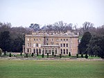
Hoton
Borough of CharnwoodCivil parishes in LeicestershireUse British English from July 2015Vague or ambiguous time from April 2014Villages in Leicestershire

Hoton is a village and civil parish in the Charnwood district of Leicestershire, England, on the A60 north-east of Loughborough, just south of the border with Nottinghamshire. Nearby places are Prestwold (to the south), Wymeswold (to the east), and Rempstone (to the north, in Nottinghamshire). At the 2011 Census, the population was 353. In 1870, Hoton was described as: "A township and chapelry in Prestwold parish, Leicester; near the river Soar and the boundary with Notts, 3¼ miles NE of Loughborough railway station"
Excerpt from the Wikipedia article Hoton (License: CC BY-SA 3.0, Authors, Images).Hoton
Wymeswold Road, Charnwood
Geographical coordinates (GPS) Address Nearby Places Show on map
Geographical coordinates (GPS)
| Latitude | Longitude |
|---|---|
| N 52.7976 ° | E -1.14902 ° |
Address
Wymeswold Road
Wymeswold Road
LE12 5SN Charnwood
England, United Kingdom
Open on Google Maps


