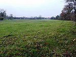
Leicester Forest West
BlabyCivil parishes in LeicestershireHamlets in LeicestershireLeicestershire geography stubsUse British English from July 2015

Leicester Forest West is a hamlet and civil parish in the Blaby district of Leicestershire, England. It has a population of about 30, making it much smaller than its neighbour, Leicester Forest East. The village takes its name from the ancient Leicester Forest.
Excerpt from the Wikipedia article Leicester Forest West (License: CC BY-SA 3.0, Authors, Images).Leicester Forest West
Hinckley Road,
Geographical coordinates (GPS) Address Nearby Places Show on map
Geographical coordinates (GPS)
| Latitude | Longitude |
|---|---|
| N 52.61 ° | E -1.266 ° |
Address
Hinckley Road
Hinckley Road
LE9 9RE , Leicester Forest West
England, United Kingdom
Open on Google Maps


