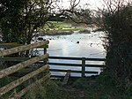
Thurlaston, Leicestershire
BlabyCivil parishes in LeicestershireUse British English from July 2015Villages in Leicestershire

Thurlaston is a village and civil parish in Leicestershire, England. It is in the Blaby local government district, just over 6 miles (9.7 km) west of the City of Leicester. The 2001 census stated that the parish had a population of 745, The 2011 census (including Frolesworth) gave the population as 807.In 1872 Thurlaston was described as: "Thurlaston, a parish, with a village and two townships, in Blaby district, Leicester; 3½ miles SSE of Desford r. station, and 6 NE of Hinckley. It has a post-office under Hinckley. Acres, 2,980. Real property, £5,914. Pop., 698. Houses, 148."
Excerpt from the Wikipedia article Thurlaston, Leicestershire (License: CC BY-SA 3.0, Authors, Images).Thurlaston, Leicestershire
Main Street,
Geographical coordinates (GPS) Address Nearby Places Show on map
Geographical coordinates (GPS)
| Latitude | Longitude |
|---|---|
| N 52.587 ° | E -1.259 ° |
Address
Elephant & Castle
Main Street 26
LE9 7TP , Thurlaston
England, United Kingdom
Open on Google Maps


