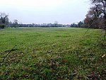
Desford
Civil parishes in LeicestershireHinckley and BosworthUse British English from May 2016Villages in Leicestershire

Desford is a village and civil parish in the Hinckley and Bosworth district of England, 7 miles (11 km) west of the centre of Leicester and around 7 miles north east of Hinckley. Situated on a hill approximately 400 feet above sea level, the parish includes the hamlets of Botcheston and Newtown Unthank and a scattered settlement at Lindridge. The population at the 2021 census had increased to 4,592. Desford is in the Doomsday Book of 1086 but the name itself is older than that meaning Deor's Ford suggesting an Anglo Saxon origin. Another suggestion is that it means 'ford frequented with wild animals'.
Excerpt from the Wikipedia article Desford (License: CC BY-SA 3.0, Authors, Images).Desford
Peckleton Lane, Hinckley and Bosworth Desford
Geographical coordinates (GPS) Address Nearby Places Show on map
Geographical coordinates (GPS)
| Latitude | Longitude |
|---|---|
| N 52.625 ° | E -1.295 ° |
Address
Peckleton Lane
Peckleton Lane
LE9 9JF Hinckley and Bosworth, Desford
England, United Kingdom
Open on Google Maps


