Taschereau (electoral district)
CanElecResTopTest with bare yearProvincial electoral districts of Quebec CityQuebec provincial electoral districts

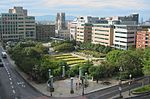
Taschereau is a provincial electoral district in the Capitale-Nationale region of Quebec, Canada that elects members to the National Assembly of Quebec. It consists of part of the La Cité-Limoilou borough of Quebec City and the tiny enclave of Notre-Dame-des-Anges. It was created for the 1973 election from parts of Jean-Talon and Saint-Sauveur electoral districts. In the change from the 2001 to the 2011 electoral map, it lost territory to Jean-Lesage and Vanier-Les Rivières but gained territory from Jean-Talon. The district is named after former Quebec Premier Louis-Alexandre Taschereau who served as premier from 1920 to 1936.
Excerpt from the Wikipedia article Taschereau (electoral district) (License: CC BY-SA 3.0, Authors, Images).Taschereau (electoral district)
Boulevard Langelier, Quebec Saint-Sauveur (La Cité-Limoilou)
Geographical coordinates (GPS) Address Nearby Places Show on map
 Continue reading on Wikipedia
 Geographical coordinates (GPS)
| Latitude | Longitude |
|---|---|
| N 46.81 ° | E -71.23 ° |
Address
Boulevard Langelier 548
G1K 3G4 Quebec, Saint-Sauveur (La Cité-Limoilou)
Quebec, Canada
Open on Google Maps