place

East Elmhurst, Queens
East Elmhurst, QueensNeighborhoods in Queens, New YorkPopulated coastal places in New York (state)
EElm3
EElm3

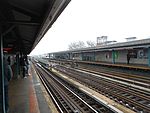
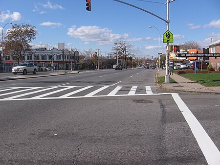
East Elmhurst is a residential neighborhood in the northwest section of the New York City borough of Queens. It is bounded to the south by Jackson Heights and Corona, to the north and east by Bowery Bay, and to the west by Woodside and Ditmars Steinway. The area also includes LaGuardia Airport, located on the shore of Flushing Bay, LaGuardia Landing Lights Fields, and Astoria Heights (the latter two in ZIP Code 11370). East Elmhurst is part of Queens Community District 3 and its ZIP Codes are 11369, 11370, and 11371. The neighborhood is patrolled by the New York City Police Department's 115th Precinct, though the airport is patrolled by the Port Authority Police Department. East Elmhurst and its southern neighbor Corona are often referred to jointly as "Corona/East Elmhurst".

Excerpt from the Wikipedia article East Elmhurst, Queens (License: CC BY-SA 3.0, Authors, Images).

East Elmhurst, Queens
Astoria Boulevard, New York Queens

Geographical coordinates (GPS) Address Nearby Places
placeShow on map

Wikipedia: East Elmhurst, QueensContinue reading on Wikipedia

Geographical coordinates (GPS)

Latitude Longitude
N 40.761 ° E -73.865 °
placeShow on map

Address

Astoria Boulevard 104-04
11369 New York, Queens
New York, United States
mapOpen on Google Maps

EElm3
EElm3
Share experience

Nearby Places

Queens
Queens

Queens is a borough of New York City, coextensive with Queens County, in the U.S. state of New York. Located on Long Island, it is the largest New York City borough by area. It is bordered by the borough of Brooklyn at the western tip of Long Island to its west, and Nassau County to its east. Queens also shares water borders with the boroughs of Manhattan, the Bronx, and Staten Island (via the Rockaways). With a population of 2,405,464 as of the 2020 census, Queens is the second most populous county in the State of New York, behind Kings County (Brooklyn), and is therefore also the second most populous of the five New York City boroughs. If Queens became a city, it would rank as the fifth most-populous in the U.S. after New York City, Los Angeles, Chicago, and Houston. Approximately 47% of the residents of Queens are foreign-born. Queens is the most linguistically diverse place on Earth and is one of the most ethnically diverse counties in the United States.Queens was established in 1683 as one of the original 12 counties of the Province of New York. The settlement was named after the English Queen and Portuguese royal princess Catherine of Braganza (1638–1705). From 1683 to 1899, the County of Queens included what is now Nassau County. Queens became a borough during the consolidation of New York City in 1898, combining the separate towns of Long Island City, Newtown, Flushing, Jamaica, and western Hempstead. With the exception of Hempstead, all are today considered neighborhoods of Queens. Queens has the most diversified economy of the five boroughs of New York City. It is home to two of New York City's airports: John F. Kennedy and LaGuardia. Landmarks in Queens which support its economy include Flushing Meadows–Corona Park; Citi Field, home to the New York Mets baseball team; the USTA Billie Jean King National Tennis Center, site of the U.S. Open tennis tournament; Kaufman Astoria Studios; Silvercup Studios; and the Aqueduct Racetrack. Flushing is undergoing rapid gentrification with investment by Chinese transnational entities, while Long Island City is undergoing gentrification secondary to its proximity across the East River from Manhattan. The borough has diverse housing, ranging from high-rise apartment buildings in some areas of western and central Queens, such as Ozone Park, Jackson Heights, Flushing, Astoria, and Long Island City, to neighborhoods with many low-rise structures in the eastern part of the borough.

USAir Flight 405
USAir Flight 405

USAir Flight 405 was a regularly scheduled domestic passenger flight between LaGuardia Airport in Queens, New York City, New York, and Cleveland, Ohio. On March 22, 1992, a USAir Fokker F28, registration N485US, flying the route, crashed in poor weather in a partially inverted position in Flushing Bay, shortly after liftoff from LaGuardia. The undercarriage lifted off from the runway, but the airplane failed to gain lift, flying only several meters above the ground. The aircraft then veered off the runway and hit several obstructions before coming to rest in Flushing Bay, just beyond the end of the runway. Of the 51 people on board, 27 were killed, including the captain and a member of the cabin crew. A similar accident had happened three years before, when Air Ontario Flight 1363 crashed shortly after takeoff at Dryden Regional Airport after ice had accumulated on the wings and airframe. Of the 69 passengers and crew, 24 were killed. The subsequent investigation revealed that due to pilot error, inadequate deicing procedures at LaGuardia, and several lengthy delays, a large amount of ice had accumulated on the wings and airframe. This ice disrupted airflow over the wing, increasing drag and reducing lift, which prevented the jet from lifting off the runway.: 77  The National Transportation Safety Board concluded that the flight crew was unaware of the amount of ice that had built up after the jet was delayed by heavy ground traffic taxiing to the runway. The report also listed the fact that the aircraft had begun its takeoff rotation too early at a lower speed than was standard as a contributing factor to the accident. Investigators also found that the deicing procedures at LaGuardia were substandard. While the jet encountered a delay up to 35 minutes, they found that the deicing fluid that was being used at the airport, and by the majority of commercial airlines across the United States, was effective for only 15 minutes. The accident led to a number of studies into the effect that ice has on aircraft, and several recommendations into prevention techniques.

One Room Schoolhouse Park

One Room Schoolhouse Park is a small park located on the southeast corner of Astoria Boulevard and 90th Street in the East Elmhurst neighborhood of Queens, New York City. Its name recalls the site of Queens's last one-room schoolhouse, demolished in 1934. The schoolhouse was built only five years after New York State required compulsory education for children in 1874. Last called P.S. 10, the school was also known as the Bowery Bay School, after an earlier school established in 1734, and as the Frogtown School. Frogtown was a poor community located in a swampy area north of Astoria Boulevard, near the present-day LaGuardia Airport. Emma Fagan headed the school from 1879 to 1910. The 15 by 28 foot classroom had capacity for fifty-two students divided into six classes. The six rows of desks were arranged according to the age and ability of the students. The beginners were seated at the smaller desks in the front, while the more advanced students occupied the back rows. In the center of the classroom, a stove with a pipe extending to the roof that kept the space warm during winter. By 1910, the expanding needs of immigrant populations and the reform movement that created the public education system had rendered one-room schoolhouses obsolete. The schoolhouse closed in 1925, but a temporary school building was still in use at the site when Parks acquired the .14-acre property from the Board of Education in 1934. Increased population in the neighborhood necessitated the construction of a new playground that opened to the public in December 1935. Subsequent decades saw the playground transformed into a sitting area. In 2015, the City Council allocated funding for the restoration of this park. The redesign of the park will commence following informational sessions to incorporate public input on the park’s features. Work on the renovation started in 2019.

Corona station (LIRR)

Corona was a station along the Port Washington Branch of the Long Island Rail Road in the Corona section of Queens, New York City. It was one of two stations built by the Flushing Railroad in Corona, this one having been at Grand Avenue (later called National Avenue, now National Street) and 45th Avenue. The station first opened as Fashion Race Course in March 1855, then renamed West Flushing, once the West Flushing station at 108th Street closed and possibly when the race track was closed in 1869, and later renamed Corona around June 1872 when the Post Office was opened under the name of Corona. The race pens were located on this street which led directly north to the Fashion Race Course. Service opened on April 2, 1855. The second depot built in September or October 1872 and was burned down on December 9, 1880. The former Corona Park depot from the White Line, abandoned four years earlier was moved to the site as a replacement around 1890 and was itself razed around September 1894. The fourth depot was built in September 1894 and was razed in 1930 due to a grade crossing elimination project. A temporary station was put in service to the south of the former location on May 8, 1930. Elevated platforms were constructed in mid-October, 1930, with westbound platforms opening on October 13 and eastbound platforms opening on October 17. The station stop was discontinued on April 8, 1964, the same year that the World's Fair station re-opened.