South Holland

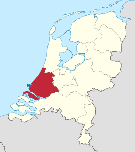
South Holland (Dutch: Zuid-Holland [ˌzœyt ˈɦɔlɑnt] (listen)) is a province of the Netherlands with a population of over 3.7 million as of October 2021 and a population density of about 1,373/km2 (3,560/sq mi), making it the country's most populous province and one of the world's most densely populated areas. Situated on the North Sea in the west of the Netherlands, South Holland covers an area of 3,307 km2 (1,277 sq mi), of which 607 km2 (234 sq mi) is water. It borders North Holland to the north, Utrecht and Gelderland to the east, and North Brabant and Zeeland to the south. The provincial capital is the Dutch seat of government The Hague, while its largest city is Rotterdam. The Rhine-Meuse-Scheldt delta drains through South Holland into the North Sea. Europe's busiest seaport, the Port of Rotterdam, is located in South Holland.
Excerpt from the Wikipedia article South Holland (License: CC BY-SA 3.0, Authors, Images).South Holland
Ringtochtpad, Zuidplas
Geographical coordinates (GPS) Address Nearby Places Show on map
Geographical coordinates (GPS)
| Latitude | Longitude |
|---|---|
| N 52 ° | E 4.6666666666667 ° |
Address
Ringtochtpad
Ringtochtpad
2841 LH Zuidplas
South Holland, Netherlands
Open on Google Maps


