place

Tyler's Ground

1856 establishments in EnglandCricket grounds in LeicestershireDefunct cricket grounds in EnglandDefunct sports venues in LeicestershireEnglish cricket ground stubs
Sport in LoughboroughSports venues completed in 1856Use British English from February 2023
General view of the rough location of Tyler's Ground

Tyler's Ground (also known as Tyler's Meadow) was a cricket ground in Loughborough, Leicestershire. It is believed the ground was located along Allsop's Lane on the edge of the town, with the ground being described as located a short distance from Loughborough railway station. The first recorded match played at the ground was in 1856, when Loughborough played an All-England Eleven. A single first-class match was played at the ground in 1875, when the North played the South, with W. G. Grace taking nine wickets in the North's first-innings and William Mycroft taking six wickets in the South's first-innings. Grace then took five wickets in the North's second-innings, ending with match figures of 14/108, while Mycroft took eight wickets in the South's second-innings to finish with match figures of 14/38. No batsman passed 26 runs, with the highest innings score being 130 in the North's second-innings. The match ended in a victory by 125 runs for the North. No further matches are recorded as being played at the ground following this date and its location is today agricultural fields.

Excerpt from the Wikipedia article Tyler's Ground (License: CC BY-SA 3.0, Authors, Images).

Tyler's Ground
Allsopp's Lane, Charnwood Cotes

Geographical coordinates (GPS) Address Nearby Places
placeShow on map

Wikipedia: Tyler's GroundContinue reading on Wikipedia

Geographical coordinates (GPS)

Latitude Longitude
N 52.7781 ° E -1.1888 °
placeShow on map

Address

Allsopp's Lane

Allsopp's Lane
LE11 1HW Charnwood, Cotes
England, United Kingdom
mapOpen on Google Maps

General view of the rough location of Tyler's Ground
Share experience

Nearby Places

Loughborough Gap
Loughborough Gap

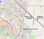
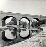
The Loughborough Gap is a 500-metre-long (0.3 mi) missing section of the Great Central Railway to the north-east of Loughborough, England. The gap was created by the removal of embankments and bridges during the 1980s and the restoration project has been branded Bridge to the Future and Bridging the Gap. From south-to-north the route crosses the Grand Union Canal, Railway Terrace road, a Factory car park, four-track Midland Main Line at Loughborough railway station and the A60 road. The Hermitage Brook watercourse runs parallel. During the 2010s work began to restore the link in order to join the northern and southern sections of two heritage railways back together giving a total Great Central Railway (heritage railway) line length of 18 miles (29 km). As of 2016, planning permission was granted for the first major component: a replacement 30-metre single-span bridge over the Midland Main Line. An additional station called Loughborough High Level will be built to connect with Loughborough (Midland) station on the Midland Main Line. As of May 2016, the bridge was intended to be owned by Charnwood Borough Council and then leased back to the Great Central Railway for one hundred years in exchange for maintenance costs. Work commenced in April 2017, with the main bridge beams being installed in September of that year. The bridge is expected to be completed in 2019.The replacement bridge was completed ahead of schedule in August 2018. However due to slight encroachment on the original trackbed, the bridge is slightly askew from the original alignment. Refurbishment has also been conducted on the canal bridge just beyond the existing train shed. Future work will see the embankment reinstated and the current train shed demolished and replaced by one close by as the shed occupies the main line alignment. In addition signalling will need be connected and updated to match the other preserved line.