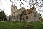
Buckworth
Civil parishes in CambridgeshireHuntingdonshireUse British English from April 2014Villages in Cambridgeshire

Buckworth is a village and civil parish in Cambridgeshire, England. Buckworth lies approximately 7 miles (11 km) northwest of Huntingdon and covers an area of 2,023 acres. It is also a part of the hundred called Leightonstone. Buckworth is situated within Huntingdonshire which is a non-metropolitan district of Cambridgeshire as well as being a historic county of England. The village is located on the slope of a hill, in the middle of farmlands and facing northeast. The road crossing Buckworth (Church Road) joins Alconbury and Barham and is the main street of the village.
Excerpt from the Wikipedia article Buckworth (License: CC BY-SA 3.0, Authors, Images).Buckworth
High Street, Huntingdonshire Buckworth
Geographical coordinates (GPS) Address Nearby Places Show on map
Geographical coordinates (GPS)
| Latitude | Longitude |
|---|---|
| N 52.38 ° | E -0.31 ° |
Address
High Street
High Street
PE28 5AR Huntingdonshire, Buckworth
England, United Kingdom
Open on Google Maps


