Eydon
Civil parishes in NorthamptonshireUse British English from March 2014Villages in NorthamptonshireWest Northamptonshire District

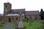
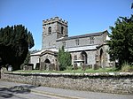
Eydon is a village and civil parish in West Northamptonshire, about 8 miles (13 km) north-east of Banbury. The village is between 510 and 540 feet (160 m) above sea level on the east side of a hill, which rises to 580 feet (180 m) and is the highest point in the parish. The parish is bounded to the west by the River Cherwell, to the south by a stream that is one of its tributaries, and to the east and north by field boundaries. The villages name means 'Aega's hill'.The 2011 Census recorded a parish population of 422.
Excerpt from the Wikipedia article Eydon (License: CC BY-SA 3.0, Authors, Images).Eydon
School Lane,
Geographical coordinates (GPS) Address Nearby Places Show on map
Geographical coordinates (GPS)
| Latitude | Longitude |
|---|---|
| N 52.1463 ° | E -1.2095 ° |
Address
School Lane
School Lane
NN11 3PH
England, United Kingdom
Open on Google Maps


