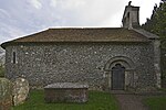
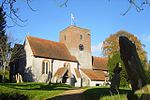
Up Nately
AC with 0 elementsVillages in Hampshire

Up Nately is a small village in Hampshire, England, located to the south east of Basingstoke. Its nearest railway station is in Hook, three miles to the east of the village. The Basingstoke Canal runs through the village from the former Penny Bridge (on the Greywell Road) in the west, under Brick Kiln Bridge (Blackstocks Lane), Slades Bridge (Heather Lane) and Eastrop Bridge (Heather Row Lane), and, to the east of the village, through the collapsed Greywell Tunnel.
Excerpt from the Wikipedia article Up Nately (License: CC BY-SA 3.0, Authors, Images).Up Nately
Blaegrove Lane, Basingstoke and Deane Mapledurwell and Up Nately
Geographical coordinates (GPS) Address Nearby Places Show on map
Geographical coordinates (GPS)
| Latitude | Longitude |
|---|---|
| N 51.2607 ° | E -1.0006 ° |
Address
Blae Grove House
Blaegrove Lane
RG27 9PD Basingstoke and Deane, Mapledurwell and Up Nately
England, United Kingdom
Open on Google Maps


