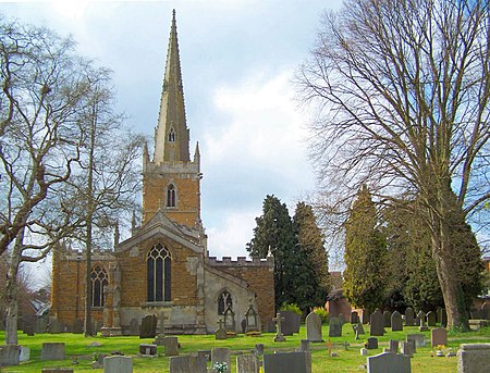
Asfordby

Asfordby is a village and civil parish in the Melton district of Leicestershire, to the west of Melton Mowbray on the A6006 road. The village is north-east of Leicester. The village's name means 'farm/settlement of Asfrothr'.The parish consists of Asfordby proper, Asfordby Valley and Asfordby Hill, which together have a population of around 3,000 (1995 est). The population had increased to 3,286 at the 2011 census. The villages are to the north of the River Wreake, with Asfordby Hill situated east of Asfordby proper, closer to Melton, and Asfordby Valley to the north. Asfordby proper is just over a mile away from the neighbouring village of Frisby on the Wreake. Within Asfordby proper, there are few shops, including a convenience stores, a fish & chip shop, an Indian restaurant, a kitchen store and a Co-operative shop. Asfordby Hall was demolished in 1965.Asfordby was the site of a modern deep coal pit, Asfordby Colliery, built between 1984 and 1993, but closed in 1997 due to numerous geological difficulties and the low price of coal at the time.
Excerpt from the Wikipedia article Asfordby (License: CC BY-SA 3.0, Authors, Images).Asfordby
Leah Way, Melton Asfordby
Geographical coordinates (GPS) Address Nearby Places Show on map
Geographical coordinates (GPS)
| Latitude | Longitude |
|---|---|
| N 52.76 ° | E -0.96 ° |
Address
Leah Way
Leah Way
LE14 3BS Melton, Asfordby
England, United Kingdom
Open on Google Maps


