place

Llofriu

Catalonia geography stubsPopulated places in Baix Empordà
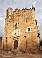
Esglèsia Llofriu
Esglèsia Llofriu

Llofriu (name of Germanic origin) is an aggregate of the town of Palafrugell (Baix Empordà), in Catalonia, Spain. As of 2005, it has 294 inhabitants. The parish church of St. Fruitós, as mentioned in a testament from 1121, was dependent on the priory of Santa Anna of Barcelona until the seizure (first third of the nineteenth century). The economy is based primarily on agriculture and livestock, although the majority of its people work today in Palafrugell, the service sector.

Excerpt from the Wikipedia article Llofriu (License: CC BY-SA 3.0, Authors, Images).

Llofriu
Carrer del Puig Muntoriol,

Geographical coordinates (GPS) Address Nearby Places
placeShow on map

Wikipedia: LlofriuContinue reading on Wikipedia

Geographical coordinates (GPS)

Latitude Longitude
N 41.930591666667 ° E 3.1312194444444 °
placeShow on map

Address

Carrer del Puig Muntoriol 4
17124
Catalonia, Spain
mapOpen on Google Maps

Esglèsia Llofriu
Esglèsia Llofriu
Share experience

Nearby Places

Mont-ras
Mont-ras

Mont-Ras (Catalan; in Spanish, Montrás) is a village and rural district situated between the larger towns of Palafrugell and Palamos on the Costa Brava in Baix Emporda, in the province of Girona, Catalonia, Spain. Mont-ras is approximately 40 minutes from Girona, or 80 minutes from Barcelona. The historic village centre sits just in the initial rise of the Gavarres hills and natural park, while the rest of the district extends across the plain to meet the Mediterranean sea at the rocky bay of El Crit just to the south of Cap Roig looking out to the Formigues Islands. The name Mont(hill)-ras(level) derives from this geographic situation. Although evidence of human habitation dates back to Roman times, the first mention of Mont-ras Torreolla came in the tenth century in reference to a watchtower that stood in at the approximate location of the current church of Saint Esteve (built 1599). Through the middle-ages Mont-ras was part of the domain of the Barons of Palafrugell and was administered as part of Palafrugell until it became a separate municipality in 1858.The elevated older village centre includes the church of Saint Esteve and the Ajuntament and a number of historic houses. The village area also includes a sports centre, library, Torre Jonama primary school (not to be confused with a school of the same name in Palafrugell). Recent developments have extended the municipality with the building of urbanisations of Torre Simone, La Roqueta, Molines and Canyelles. There are a number of factories, commercial units and potteries situated along the C31/C66 Palamós to Girona Road. The municipality includes a number of older fortified masia farms and towers (torres) built against the raiding of the Barbary pirates. The cove of El Crit (The Scream) takes its name from a legend of a local girl killed by pirates. In the hills behind the village are a number of disused mines and quarries along with cork trees that contributed to the local cork-making industries. The Mont-ras plain includes the Ruta de la Petit Tren walking and cycling route linking Mont-ras with the beaches of La Fosca, Castell and Calella de Palafrugell. As a result, the area is popular with walkers and mountain bikers. Mont-ras includes a number of campsites and the tennis club Costa Brava. Mont-ras football club is one of the many Costa Brava clubs that host the Mediterranean International Cup youth football tournament each Easter.

Calella de Palafrugell

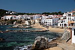
Calella de Palafrugell is one of three coastal towns belonging to the municipality of Palafrugell in the province of Girona, Spain. The other two towns are Llafranc, only one kilometre (0.62 mi) to the north, and Tamariu, some four kilometres (2.5 mi) to the north. All three towns are part of the Costa Brava, the coastal region of northeastern Catalonia, in the comarca of Baix Empordà. It should not be confused with the larger, more commercialised resort of Calella, which is further south towards Barcelona, in the comarca of Maresme.Calella de Palafrugell has an excellent setting and, whilst busy in the summer season, it does not have the large hotels and mass tourism of other Costa Brava resorts such as Lloret de Mar. The town has a number of good standard hotels, apartments and, at a distance from the beach, some campsites. Like much of the picturesque section of the Costa Brava, north of Palamos and south of L'Estartit, Calella has moved steadily upmarket in recent times and offers some very high quality restaurants and hotels - at prices to match. The beaches are Blue Flag standard. Calella de Palafrugell is a very popular destination dominated by apartments blocks set just back enough not to be seen from the beach.The town's origin is that of a fishing village, and its old maritime quarter, the Port Bo has been declared a cultural asset of national importance. This quarter retains the original layout of the village, with its traditional white porched buildings. It includes the complex of vaults, originally used to sew nets and auction fish, but now occupied by restaurants. The vaults are fronted by the beaches of Platja del Port de Malaspina and Platja de Portbò, which formed a natural fishing port and are still home to a fleet of small fishing boats. Also in Port Bo is the Sa Perola Interpretation Centre, housed in a former net dyeing house and now used as a tourist office and interpretation centre for the fishing industry and maritime heritage of the district.Calella de Palafrugell has a number of small coves and beaches linked via a well engineered coastal walk known as the Cami de Ronda, passing along the cliffs and through several tunnels on the way. From the north the first of the beaches is Platja del Canadell, with its beach restaurant. Platja del Port de Malaspina, Platja de Portbò and Platja d'en Calau are linked sandy coves located in the centre of Calella. These are followed by Platgeta d'en Cosme, Platje de Port Pelegri, Platja de Sant Roc and Platja del Golfet, the last of which is approximately 1.5 kilometres (0.93 mi) from central Calella.Beyond Platja del Golfet is the Cap Roig headland, where the Castell de Cap Roig is situated, surrounded by large botanical gardens. The castle has also been declared a cultural asset of national importance. The castle was built, and the gardens created, between 1929 and 1975, by Nicholas Woevodski and Dorothy Webster. The Cap Roig Festival, a music and dance festival, is held in the gardens between July and August.The GR 92 long-distance footpath, which runs the length of the Mediterranean coast of Spain, passes along the Cami de Ronda. To the north of Platja del Canadell the path follows the coast the short distance to Llafranc, passing the 16th century Torre de Calella on the way. To the south the path takes an inland route from Platja del Golfet, bypassing Cap Roig through pine and cork oak forests to the fisherman's village at S'Alguer and the beach at La Fosca.