place

Regencós

Municipalities in Baix EmpordàPages with Catalan IPAPopulated places in Baix EmpordàProvince of Girona geography stubs
Regencos
Regencos

Regencós (Catalan pronunciation: [rəʒəŋˈkos]) is a village in the province of Girona and autonomous community of Catalonia, Spain. The municipality covers an area of 6.23 square kilometres (2.41 sq mi) and the population in 2014 was 291.

Excerpt from the Wikipedia article Regencós (License: CC BY-SA 3.0, Authors, Images).

Regencós
Carrer de Salincs,

Geographical coordinates (GPS) Address Nearby Places
placeShow on map

Wikipedia: RegencósContinue reading on Wikipedia

Geographical coordinates (GPS)

Latitude Longitude
N 41.95 ° E 3.1666666666667 °
placeShow on map

Address

Carrer de Salincs

Carrer de Salincs
17214
Spain
mapOpen on Google Maps

Regencos
Regencos
Share experience

Nearby Places

Mont-ras
Mont-ras

Mont-Ras (Catalan; in Spanish, Montrás) is a village and rural district situated between the larger towns of Palafrugell and Palamos on the Costa Brava in Baix Emporda, in the province of Girona, Catalonia, Spain. Mont-ras is approximately 40 minutes from Girona, or 80 minutes from Barcelona. The historic village centre sits just in the initial rise of the Gavarres hills and natural park, while the rest of the district extends across the plain to meet the Mediterranean sea at the rocky bay of El Crit just to the south of Cap Roig looking out to the Formigues Islands. The name Mont(hill)-ras(level) derives from this geographic situation. Although evidence of human habitation dates back to Roman times, the first mention of Mont-ras Torreolla came in the tenth century in reference to a watchtower that stood in at the approximate location of the current church of Saint Esteve (built 1599). Through the middle-ages Mont-ras was part of the domain of the Barons of Palafrugell and was administered as part of Palafrugell until it became a separate municipality in 1858.The elevated older village centre includes the church of Saint Esteve and the Ajuntament and a number of historic houses. The village area also includes a sports centre, library, Torre Jonama primary school (not to be confused with a school of the same name in Palafrugell). Recent developments have extended the municipality with the building of urbanisations of Torre Simone, La Roqueta, Molines and Canyelles. There are a number of factories, commercial units and potteries situated along the C31/C66 Palamós to Girona Road. The municipality includes a number of older fortified masia farms and towers (torres) built against the raiding of the Barbary pirates. The cove of El Crit (The Scream) takes its name from a legend of a local girl killed by pirates. In the hills behind the village are a number of disused mines and quarries along with cork trees that contributed to the local cork-making industries. The Mont-ras plain includes the Ruta de la Petit Tren walking and cycling route linking Mont-ras with the beaches of La Fosca, Castell and Calella de Palafrugell. As a result, the area is popular with walkers and mountain bikers. Mont-ras includes a number of campsites and the tennis club Costa Brava. Mont-ras football club is one of the many Costa Brava clubs that host the Mediterranean International Cup youth football tournament each Easter.

Begur, Spain
Begur, Spain

Begur is a village and municipality in the comarca of Baix Empordà and province of Girona in Catalonia, Spain. The village itself lies some 2 kilometres (1.2 mi) from, and 200 metres (660 ft) above, the coastline of the Costa Brava, but the municipality includes several seaside resorts.The municipality of Begur has 3,986 inhabitants (according to the census of 2005). It is an important tourist attraction in the Baix Empordà. During the summer, the population can exceed 40,000 people. Despite its tourist character, the village has important historical remnants that go back in early history. The castle of Begur is a good example of medieval remains. The castle was constructed in the 16th and 17th centuries. The municipality of Begur also includes Esclanyà (with a Romanesque old part), Aiguafreda, Sa Riera, Sa Tuna, Aiguablava and Fornells. Some of the most prestigious beaches of the Costa Brava can be found here: Sa Riera, Aiguafreda, sa Tuna, Platja Fonda (although it has been almost completely destroyed by storms), Fornells and Aiguablava. The latter is also home to a Parador Hotel. The annual festival to celebrate St. Tania takes places each November. The village of Begur is a staging point on the GR 92 long distance footpath, which runs the length of the Mediterranean coast of Spain. Stage 7, to the north, takes an inland route via Pals, Palau-sator, Fontanilles and Gualta to the next staging point at Torroella de Montgrí, a distance of 21.3 kilometres (13.2 mi). Stage 8, to the south, heads to Sa Tuna and Fornells de Mar before following the coast further south through Tamariu, Llafranc and Calella de Palafrugell to the next staging point at Palamós, a distance of 23.0 kilometres (14.3 mi).
Tamariu
Tamariu

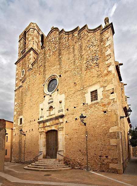
Tamariu (Catalan pronunciation: [təməˈɾiw], Catalan for tamarisk) is one of three coastal towns belonging to the municipality of Palafrugell, province of Girona, Spain, the other two being Calella de Palafrugell and Llafranc. It is part of the Costa Brava, the coastal region of northeastern Catalonia, in the comarca of Baix Empordà. It is situated about 70 mi (110 km) south of the border with France and close to the nearby inland towns of Palafrugell and Begur.The name Tamariu derives from the presence of many tamarisk trees along the promenade, which separates the beach from the narrow streets and whitewashed buildings of the town. Tamariu was originally a small fishing village, and fishing boats are still to be seen drawn up on the beach. Today they have been joined by a few hotels, along with seafood restaurants, cafes and bars.Tamariu is set amongst rugged pine covered cliffs flanking the Mediterranean Sea. The crystal clear waters around this area are amongst the purest on the coast. The south-facing blue flag beach is ideal for swimming as the it shelves at a fairly gentle angle. It is also popular as a dive site as there are many caves to explore along with the submerged mountain of the Llosa de Cala Nova.The GR 92 long distance footpath, which runs the length of the Mediterranean coast of Spain, passes through the town. To the north the path takes an inland route through pine and cork oak forests to the beach at Aiguablava before following the coast to Fornells. To the south the path follows an, in places rough, track above the shore line to the beach at Cala Pedrosa, the Sant Sebastià lighthouse, and the town of Llafranc.Aigua Gelida is the largest urbanisation in Tamariu filling the gap between Tamariu and Aiguablava. Aigua Gelida has a small sandy cove predominantly for residents of Cala Nostra just 300m away. Building restrictions are not as strict in Aigua Gelida and so many modern villas have been built in the past few years.