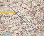
Bedfont

Bedfont is a suburb in the London Borough of Hounslow, approximately 15 miles (24 km) west of Charing Cross. Originally a distinct village, Bedfont has a large central conservation area around Bedfont Green. The majority of the housing was built at a time of an emerging economy of aviation and distribution-related businesses. The area was formerly part of the Staines Rural District and was one of the formerly agricultural areas chosen for significant low-rise social housing, planned and built in the mid 20th century. Bedfont straddles Staines Road (A315) and traditionally includes North Feltham north of Staines Road – a mainly commercial area – and the neighbourhood of Hatton. The heart of the area has many parks and the south-eastern streets and Cage Park are contiguous with the larger district of Feltham. East is the River Crane around which are a few remaining parts of Hounslow Heath. The nearest railway station is at Feltham and the area adjoins the Hatton Cross Underground station on the Piccadilly line. Heathrow Airport is 2 miles (3 km) to the north.
Excerpt from the Wikipedia article Bedfont (License: CC BY-SA 3.0, Authors, Images).Bedfont
Fawn's Manor Close, London Bedfont (London Borough of Hounslow)
Geographical coordinates (GPS) Address Nearby Places Show on map
Geographical coordinates (GPS)
| Latitude | Longitude |
|---|---|
| N 51.45 ° | E -0.44 ° |
Address
Fawn's Manor Close (Fawns Manor Close)
Fawn's Manor Close
TW14 8EN London, Bedfont (London Borough of Hounslow)
England, United Kingdom
Open on Google Maps


