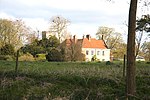
Troston
Borough of St EdmundsburyCivil parishes in SuffolkSuffolk geography stubsVillages in Suffolk

Troston is a village and civil parish in Suffolk, England, five miles north-east of Bury St Edmunds. Its parish church contains rare mediaeval wall paintings, including dragon-slaying and the Martyrdom of St Edmund. The local pub, The Bull, had been a central part of the village since the late 1800s, but was closed, leaving it boarded up. Owners, brewers Greene King, sold it, and The Bull has now reopened as a Free House with a restaurant.Troston Hall, to the south of the village, is a Grade II* listed late sixteenth-century manor house, with the Grade II listed Hall Farm to its north.There are 16 listed buildings in the village.
Excerpt from the Wikipedia article Troston (License: CC BY-SA 3.0, Authors, Images).Troston
Pear Tree Close, West Suffolk
Geographical coordinates (GPS) Address Nearby Places Show on map
Geographical coordinates (GPS)
| Latitude | Longitude |
|---|---|
| N 52.314 ° | E 0.783 ° |
Address
Pear Tree Close
Pear Tree Close
IP31 1FA West Suffolk
England, United Kingdom
Open on Google Maps


