Ixworth Thorpe
Borough of St EdmundsburyCivil parishes in SuffolkSuffolk geography stubsVillages in Suffolk

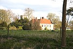
Ixworth Thorpe is a small village and civil parish in the West Suffolk district of the English county of Suffolk. The village is located on the A1088 road around 2 miles (3.2 km) north-west of the larger village of Ixworth and 7 miles (11.3 km) north-east of Bury St Edmunds. In 2005 its estimated population was 60. The parish council is operated jointly with Ixworth. From the 2011 Census the population of the village was not recorded separately.
Excerpt from the Wikipedia article Ixworth Thorpe (License: CC BY-SA 3.0, Authors, Images).Ixworth Thorpe
Thetford Road, West Suffolk
Geographical coordinates (GPS) Address Nearby Places Show on map
Geographical coordinates (GPS)
| Latitude | Longitude |
|---|---|
| N 52.321 ° | E 0.811 ° |
Address
Thetford Road 26
IP31 1QH West Suffolk
England, United Kingdom
Open on Google Maps


