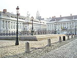
Rue Neuve, Brussels
City of BrusselsPedestrian malls in BelgiumStreets in BrusselsUse British English from October 2021

The Rue Neuve (French) or Nieuwstraat (Dutch), meaning "New Street", is a pedestrian street in central Brussels, Belgium. It runs between the Place de la Monnaie/Muntplein to the south and the Place Charles Rogier/Karel Rogierplein to the north. The Rue Neuve and its close surroundings are the second most popular shopping area in Belgium by number of shoppers, after Meir in Antwerp. It is served by the metro and premetro (underground tram) stations De Brouckère (on lines 1, 3, 4 and 5) and Rogier (on lines 2, 3, 4 and 6).
Excerpt from the Wikipedia article Rue Neuve, Brussels (License: CC BY-SA 3.0, Authors, Images).Rue Neuve, Brussels
Rue du Damier - Dambordstraat, City of Brussels Pentagon (Brussels)
Geographical coordinates (GPS) Address Nearby Places Show on map
Geographical coordinates (GPS)
| Latitude | Longitude |
|---|---|
| N 50.853055555556 ° | E 4.3563888888889 ° |
Address
Centre - Centrum
Rue du Damier - Dambordstraat 26
1000 City of Brussels, Pentagon (Brussels)
Belgium
Open on Google Maps


