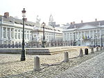
Boulevard Adolphe Max

The Boulevard Adolphe Max (French) or Adolphe Maxlaan (Dutch) is a central boulevard in Brussels, Belgium. It was created following the covering of the river Senne (1867–1871), and bears the name of a former mayor of the City of Brussels, Adolphe Max (1869–1939). The Boulevard Adolphe Max is located between the Place de Brouckère/De Brouckèreplein and the Place Charles Rogier/Karel Rogierplein, in the extension of the Boulevard Anspach/Anspachlaan. It runs parallel to Brussels' busiest shopping street, the Rue Neuve/Nieuwstraat. It is served by the metro and premetro (underground tram) stations De Brouckère (on lines 1, 3, 4 and 5) and Rogier (on lines 2, 3, 4 and 6).
Excerpt from the Wikipedia article Boulevard Adolphe Max (License: CC BY-SA 3.0, Authors, Images).Boulevard Adolphe Max
Boulevard Adolphe Max - Adolphe Maxlaan, City of Brussels Pentagon (Brussels)
Geographical coordinates (GPS) Address Nearby Places Show on map
Geographical coordinates (GPS)
| Latitude | Longitude |
|---|---|
| N 50.853611111111 ° | E 4.3555555555556 ° |
Address
Boulevard Adolphe Max - Adolphe Maxlaan 88
1000 City of Brussels, Pentagon (Brussels)
Belgium
Open on Google Maps


