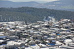
Dallata
Arab villages depopulated during the 1948 Arab–Israeli WarDistrict of SafadPages with non-numeric formatnum arguments

Dallata (Arabic: دلاّتة) was a Palestinian Arab village, located on a hilltop 6 kilometers (3.7 mi) north of Safad. Constructed upon an ancient site, it was known to the Crusaders as Deleha. Dallata was included in the late 16th century Ottoman census and British censuses of the 20th century. Its inhabitants were primarily agriculturalists, with some involved in carpentry or trade. Dallata was depopulated during the 1948 Palestine war on around May 10, 1948 by the Palmach's First Battalion of Operation Yiftach. Following the establishment of Israel, the Israeli locality of Dalton was established about 1 kilometer (0.62 mi) southwest of the village site.
Excerpt from the Wikipedia article Dallata (License: CC BY-SA 3.0, Authors, Images).Dallata
Merom HaGalil Regional Council
Geographical coordinates (GPS) Address Nearby Places Show on map
Geographical coordinates (GPS)
| Latitude | Longitude |
|---|---|
| N 33.021944444444 ° | E 35.498888888889 ° |
Address
Merom HaGalil Regional Council
North District, Israel
Open on Google Maps


