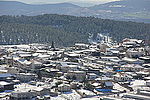
Taytaba
Arab villages depopulated during the 1948 Arab–Israeli WarDistrict of SafadPages with non-numeric formatnum arguments

Taytaba (Arabic: طيطبا, also spelled Teitaba) was a Palestinian-Arab village in the Safad Subdistrict, located 5 kilometers north of Safad. It was depopulated during the 1947–1948 Civil War in Mandatory Palestine in May 1948 under Operation Hiram. In 1945 it had a population of 530 and a total area of 8,453 dunams, 99.8% of which was Arab-owned.It was situated in a rocky area located along the crest of a basaltic hill that overlooks Wadi Taytaba, a tributary of Wadi Waqqas, to the southeast. It was connected to a highway leading to Safad via a secondary road and connected to many of the surrounding villages through secondary roads as well.
Excerpt from the Wikipedia article Taytaba (License: CC BY-SA 3.0, Authors, Images).Taytaba
886, Merom HaGalil Regional Council
Geographical coordinates (GPS) Address Nearby Places Show on map
Geographical coordinates (GPS)
| Latitude | Longitude |
|---|---|
| N 33.013333333333 ° | E 35.476388888889 ° |
Address
886
1311502 Merom HaGalil Regional Council
North District, Israel
Open on Google Maps


