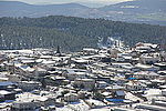
Galilee earthquake of 1837

The Galilee earthquake of 1837, often called the Safed earthquake, shook the Galilee on January 1 and is one of a number of moderate to large events that have occurred along the Dead Sea Transform (DST) fault system that marks the boundary of two tectonic plates; the African Plate on the west and the Arabian Plate on the east. Intensity assessments for the event were VIII (Damaging) on the Medvedev–Sponheuer–Karnik scale and VIII (Heavily damaging) on the European Macroseismic Scale. A 1977 assessment of the event that was published in the Bulletin of the Seismological Society of America had the epicenter just north of the city of Safed and the magnitude of 6.25–6.5, but in 1997 seismologist Nicholas Ambraseys argued that the event may have been more substantial. The event was well-documented by the nineteenth-century missionary, archaeologist, and author William McClure Thomson. The region in which the earthquake occurred was formally part of the Ottoman Empire but at the time, it was under control of the Egyptians, who were occupying after they had seized it during conflict.
Excerpt from the Wikipedia article Galilee earthquake of 1837 (License: CC BY-SA 3.0, Authors, Images).Galilee earthquake of 1837
Merom HaGalil Regional Council
Geographical coordinates (GPS) Address Nearby Places Show on map
Geographical coordinates (GPS)
| Latitude | Longitude |
|---|---|
| N 33 ° | E 35.5 ° |
Address
1311502 Merom HaGalil Regional Council
North District, Israel
Open on Google Maps


