place

Watershoot Bay

Bays of the Isle of WightUse British English from June 2015
Watershoot Bay
Watershoot Bay

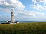
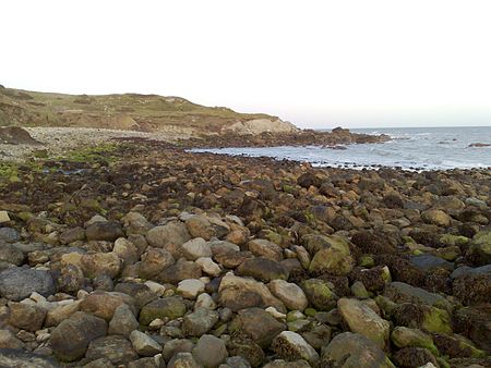
Watershoot Bay is a bay on the southernmost tip of the Isle of Wight, England. It lies 1+1⁄2 miles (2.4 km) to the south-west of the village of Niton. It faces south out into the English Channel, and is one of the smallest and remotest bays of the Isle of Wight with a rocky shoreline only around 500 feet (150 m) in length. It lies to the west of St. Catherine's Point lighthouse and is surrounded by a 170-acre area of undulating grassland and scrub owned by the National Trust and known as Knowles Farm.The beach is composed predominantly of sandstone, chalk and chert boulders (which are around 90 to 110 million years old) which are rich in fossils.The bay is best accessed from the car park about 350 yards (320 m) to the north or from the road that leads to the lighthouse but will involve a hike over rough terrain.The name of the bay may have come from that of a sloop lost there in 1755. The bay was home to a boathouse from the mid-19th century to the early 20th century.

Excerpt from the Wikipedia article Watershoot Bay (License: CC BY-SA 3.0, Authors, Images).

Watershoot Bay
Old Blackgang Road,

Geographical coordinates (GPS) Address Nearby Places
placeShow on map

Wikipedia: Watershoot BayContinue reading on Wikipedia

Geographical coordinates (GPS)

Latitude Longitude
N 50.58 ° E -1.3 °
placeShow on map

Address

Old Blackgang Road

Old Blackgang Road
PO38 2NP , Niton and Whitwell
England, United Kingdom
mapOpen on Google Maps

Watershoot Bay
Watershoot Bay
Share experience

Nearby Places

St. Catherine's Down

St. Catherine's Down is a chalk down on the Isle of Wight, located near St Catherine's Point, the southernmost point on the island. The Down rises to 240 metres at its highest point, between the towns of Niton and Chale. Upon the hill is St. Catherine's Oratory (known locally as "the pepperpot"), which is a stone lighthouse built in the 14th century by Walter De Godeton. It is the second oldest, and only surviving, medieval lighthouse in the British Islands: only the Roman lighthouse at Dover is older. Reportedly, de Godeton was found guilty for having plundered wine that belonged to the Church from the shipwreck of the St. Marie of Bayonne in Chale Bay. He was ordered to make amends, under threat of excommunication, by building and maintaining the lighthouse. It was completed after his death, and staffed by a priest; fires were lit in the tower to warn ships of the coast. There was originally a chapel attached, which has since been demolished. A Bronze Age barrow near the Oratory was excavated in the 1920s. A replacement lighthouse was begun in 1785 but was never completed because the Down is prone to dense fog. Locally, the surviving foundations are known as the "salt cellar". After the wreck of the Clarendon in 1837, a new lighthouse, St Catherine's Lighthouse, was built to the west of Niton at the foot of the Undercliff. The River Medina, the main river of the Isle of Wight, rises at St Catherine's Down and flows northwards through the county town Newport, towards the Solent at Cowes.