place

Hoyo de Manzanares

Madrid geography stubsMunicipalities in the Community of Madrid

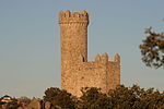
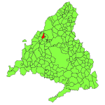
Hoyo de Manzanares is a municipality of the Community of Madrid, Spain, and is located on the northwestern side of the Community of Madrid and to the south of the Sierra de Guadarrama. It has a stable population of roughly 7,457 residents (INE 2008), a statistic that has been increasing consistently from the economic crisis of 2008/9 onwards. The population also greatly increases during the summer due to an influx of various families who own summer houses in the area. This district of Madrid is found inside the Cuenca Alta del Manzanares Regional Park created by the Community of Madrid in 1985. This regional park is the oldest and most protected regional park in the Community of Madrid. As a result, Hoyo de Manzanares is surrounded by mountains and fields that give the town a beautiful location. The only way to arrive in Hoyo de Manzanares from the city of Madrid is via the M-618 highway, which bisects the regional park, passing the nearby towns of Torrelodones, Colmenar Viejo, and finally Hoyo de Manzanares.

Excerpt from the Wikipedia article Hoyo de Manzanares (License: CC BY-SA 3.0, Authors).

Hoyo de Manzanares
Carretera de Colmenar,

Geographical coordinates (GPS) Address Nearby Places
placeShow on map

Wikipedia: Hoyo de ManzanaresContinue reading on Wikipedia

Geographical coordinates (GPS)

Latitude Longitude
N 40.633333333333 ° E -3.8833333333333 °
placeShow on map

Address

Carretera de Colmenar
28240
Community of Madrid, Spain
mapOpen on Google Maps

Share experience

Nearby Places

Torrelodones
Torrelodones

Torrelodones is a municipality in the northwest of the Autonomous Community of Madrid, Spain. It is situated 29 kilometers northwest from the city of Madrid. Because of its location between the Sierra de Guadarrama and the metropolitan area of the capital, it is linked to two districts in Madrid: the agricultural area of Guadarrama and the metropolitan area of Madrid. It lies at an average altitude of 845 meters. According to the 2014 census, 22,838 people live in the municipality, distributed among seven towns. The people of Torrelodones earn among the highest per capita incomes of the Community of Madrid. Services, hotels, and construction are the main economic activities. In 2012 it had about 22,680 inhabitants. With over three colleges and four developments, Torrelodones is usually divided into two parts: the "Torrelodones town", where there is the Town Hall, and the "Torrelodones colony", where there are schools, homes and small businesses. Torrelodones is bordered to the north by Hoyo de Manzanares, to the south by Las Rozas de Madrid, to the west by Galapagar, and to the east by Madrid (through El Monte de El Pardo). Historically the municipality was named "Torrelodones" (Lodones' Tower). That name led to the current name of the town Torrelodones. The name comes from, for one side, the Muslim watchtower that Muslims used during Al-andalus age to guard the city from the attacks of Christian people during the Iberian peninsula's reconquest. For the other side, "Lodon" (hack berry) is a type of tree that was really abundant in that zone whose scientific name is Celtis australis.