place

La Ciudad del Fútbol

2003 establishments in SpainAssociation football training grounds in SpainBuildings and structures in the Community of MadridFootball academies in SpainLas Rozas de Madrid
National football academiesRoyal Spanish Football FederationSports venues completed in 2003
Ciudad del Fútbol
Ciudad del Fútbol

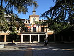
Officially La Ciudad del Fútbol de la Real Federación Española de Fútbol (English: The Football City of the Royal Spanish Football Federation) is a football training facility opened in 2003, serving as the headquarters of the Royal Spanish Football Federation as well as the official training centre of the Spanish football team. It is located in the municipality of Las Rozas de Madrid around 20 km northwest of the capital Madrid, within the Community of Madrid.

Excerpt from the Wikipedia article La Ciudad del Fútbol (License: CC BY-SA 3.0, Authors, Images).

La Ciudad del Fútbol
Avenida de Esparta,

Geographical coordinates (GPS) Address Nearby Places
placeShow on map

Wikipedia: La Ciudad del FútbolContinue reading on Wikipedia

Geographical coordinates (GPS)

Latitude Longitude
N 40.524 ° E -3.901 °
placeShow on map

Address

Ciudad del Fútbol de Las Rozas

Avenida de Esparta
28232 , La Dehesa
Community of Madrid, Spain
mapOpen on Google Maps

Ciudad del Fútbol
Ciudad del Fútbol
Share experience

Nearby Places

Las Rozas de Madrid
Las Rozas de Madrid

Las Rozas de Madrid (or simply, Las Rozas; Spanish pronunciation: [las ˈɾɔθas]) is one of the largest townships and municipalities in the autonomous community of Madrid, Spain, with an area of 59 km² (22¾ sq. mi.)[1]. It is located 20 km (12 miles) northwest of the city of Madrid itself, on the A-6 freeway to A Coruña. Las Rozas is the beginning of this freeway, near the fork road M-505 to El Escorial, which marks the southern boundary of this 'comarca' or rural district (although it is no longer rural). The municipality is served by four Renfe railway stations– Las Rozas, Las Matas, El Pinar and El Tejar. A fifth stop, at Peñascales was closed. The municipality shares borders with Torrelodones to the north, Villanueva del Pardillo and Galapagar to the west, the park of Monte del Pardo in the east and Majadahonda (south). Las Rozas has one of the highest average per capita incomes in the Community of Madrid. During the final decades of the 20th century the town has experienced a vigorous building program, mostly as a dormitory town for Madrid, with a correspondingly strong population growth, which more than doubled between 1991 and 2005 (from 35,137 to 76,246 inhabitants). The provisioning for local services (such as schools and new dwellings) has at times been outpaced by the locality's high birth and immigration rates. However, by 2010 the community was well served in all health, education and social sectors.

Torrelodones
Torrelodones

Torrelodones is a municipality in the northwest of the Autonomous Community of Madrid, Spain. It is situated 29 kilometers northwest from the city of Madrid. Because of its location between the Sierra de Guadarrama and the metropolitan area of the capital, it is linked to two districts in Madrid: the agricultural area of Guadarrama and the metropolitan area of Madrid. It lies at an average altitude of 845 meters. According to the 2014 census, 22,838 people live in the municipality, distributed among seven towns. The people of Torrelodones earn among the highest per capita incomes of the Community of Madrid. Services, hotels, and construction are the main economic activities. In 2012 it had about 22,680 inhabitants. With over three colleges and four developments, Torrelodones is usually divided into two parts: the "Torrelodones town", where there is the Town Hall, and the "Torrelodones colony", where there are schools, homes and small businesses. Torrelodones is bordered to the north by Hoyo de Manzanares, to the south by Las Rozas de Madrid, to the west by Galapagar, and to the east by Madrid (through El Monte de El Pardo). Historically the municipality was named "Torrelodones" (Lodones' Tower). That name led to the current name of the town Torrelodones. The name comes from, for one side, the Muslim watchtower that Muslims used during Al-andalus age to guard the city from the attacks of Christian people during the Iberian peninsula's reconquest. For the other side, "Lodon" (hack berry) is a type of tree that was really abundant in that zone whose scientific name is Celtis australis.