place

Collado Villalba

Madrid geography stubsMunicipalities in the Community of MadridPages with Spanish IPA
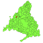
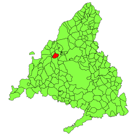
Collado Villalba (Madrid) mapa

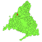
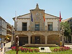
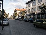
Collado Villalba (Spanish pronunciation: [koˈʎaðo βiˈʎalβa]) is a municipality of the Community of Madrid, in central Spain. It is located 40.3 kilometres north-west of the city of Madrid, at an altitude of 917 meters above sea level. It has a population of 64,263 (2022), with a population density of about 2,400 per km². Collado Villalba has a hot summer Mediterranean climate (Köppen Csa).

Excerpt from the Wikipedia article Collado Villalba (License: CC BY-SA 3.0, Authors, Images).

Collado Villalba
Urbanización Venecia,

Geographical coordinates (GPS) Address Nearby Places
placeShow on map

Wikipedia: Collado VillalbaContinue reading on Wikipedia

Geographical coordinates (GPS)

Latitude Longitude
N 40.633333333333 ° E -4.0083333333333 °
placeShow on map

Address

Urbanización Venecia
28400 , La Estación
Community of Madrid, Spain
mapOpen on Google Maps

Collado Villalba (Madrid) mapa
Share experience

Nearby Places

Los Negrales
Los Negrales

Los Negrales is a residential zone in the municipal area of Collado Villalba, Alpedrete, San Lorenzo de El Escorial, Guadarrama and Galapagar (municipalities of the northwest of the Community of Madrid, Spain), consisting mostly of detached houses. Although it was divided in three administrative zones, Los Negrales is a contiguous residential area. This residential zone was built gradually. The oldest houses date to the first half of the 20th century, and building has continued until contemporary times. A significant part of the houses are second residences of their owners, therefore, in summer and in holidays the population doubles. Los Negrales is situated near the Sierra de Guadarrama and near the centre of Collado Villalba, which makes it a favorable place to spend the holidays. The short distance to Collado Villalba facilitates shopping and leisure. Los Negrales has considerable public facilities (parish church, public schools, a sports center, a municipal park and a pharmacy, among others). This area is divided in two parts: Los Negrales (neighbourhood) and the Colony Fuentellana (where the station of Los Negrales is located), and both zones are divided by the avenue of Reina Victoria (ancient N-SAW or road of La Coruña). Los Negrales has public bus service and has a train station of the line C-8b of Cercanías Madrid called Los Negrales, situated in the municipality of Alpedrete. The motorway Autopista del Noroeste passes north of Los Negrales, as does the highway Carretera Nacional N-VI. Another main road, M-510, runs along the western side of Los Negrales, and the junction of the three roads is located in the north-west of the area. The name of Los Negrales is based upon a nearby forest of black pine (pino negral in Spanish). Its patron saint is Our Lady of Mount Carmel, on whose feast day (16 July) a procession is held. Los Negrales is home to an Augustine college, a Theresian institution, a community of the Claretians, and a hall of Jehovah's Witnesses.
Torrelodones
Torrelodones

Torrelodones is a municipality in the northwest of the Autonomous Community of Madrid, Spain. It is situated 29 kilometers northwest from the city of Madrid. Because of its location between the Sierra de Guadarrama and the metropolitan area of the capital, it is linked to two districts in Madrid: the agricultural area of Guadarrama and the metropolitan area of Madrid. It lies at an average altitude of 845 meters. According to the 2014 census, 22,838 people live in the municipality, distributed among seven towns. The people of Torrelodones earn among the highest per capita incomes of the Community of Madrid. Services, hotels, and construction are the main economic activities. In 2012 it had about 22,680 inhabitants. With over three colleges and four developments, Torrelodones is usually divided into two parts: the "Torrelodones town", where there is the Town Hall, and the "Torrelodones colony", where there are schools, homes and small businesses. Torrelodones is bordered to the north by Hoyo de Manzanares, to the south by Las Rozas de Madrid, to the west by Galapagar, and to the east by Madrid (through El Monte de El Pardo). Historically the municipality was named "Torrelodones" (Lodones' Tower). That name led to the current name of the town Torrelodones. The name comes from, for one side, the Muslim watchtower that Muslims used during Al-andalus age to guard the city from the attacks of Christian people during the Iberian peninsula's reconquest. For the other side, "Lodon" (hack berry) is a type of tree that was really abundant in that zone whose scientific name is Celtis australis.