New Kent Road

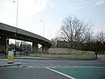
New Kent Road is a 1 kilometre (0.6 mi) road in the London Borough of Southwark. The road was created in 1751 when the Turnpike Trust upgraded a local footpath. This was done as part of the general road improvements associated with the creation of Westminster Bridge; in effect it was possible to travel from the West End/ Westminster to the south-east without having to go via the Borough of Southwark but could now cross St George's Fields to the junction of Newington Causeway and Newington Butts which is where New Kent Road starts at Elephant and Castle. The route runs eastward for a few hundred yards to the junction of Great Dover Street and Tower Bridge Road, known as Bricklayers Arms, where it joins the original route to the south-east Old Kent Road (the A2). The road forms part of the London Inner Ring Road and as such forms part of the boundary of the London congestion charge zone. New Kent Road is designated the A201 which, to the north-west past the Elephant and Castle, becomes London Road. In 1878, historian Edward Walford noted that the New Kent Road was formerly named Greenwich Road, and explained that "[it] is a broad and open roadway; it has been lately planted on either side with trees, so that in course of time it will doubtless form a splendid boulevard, of the Parisian type, and one worthy of being copied in many other parts of London."The 1955 Survey of London still maintained that "[the] road also has a spaciousness lacking in many of its 19th-century counterparts, for the 1751 Act stipulated that the road should be not less than 42 feet (13 m) wide and many of the older houses still retain their front gardens." Just a few older houses still remain, mostly on the south side.
Excerpt from the Wikipedia article New Kent Road (License: CC BY-SA 3.0, Authors, Images).New Kent Road
New Kent Road, London Walworth (London Borough of Southwark)
Geographical coordinates (GPS) Address Nearby Places Show on map
Geographical coordinates (GPS)
| Latitude | Longitude |
|---|---|
| N 51.494166666667 ° | E -0.092777777777778 ° |
Address
New Kent Road 157-159
SE1 4AG London, Walworth (London Borough of Southwark)
England, United Kingdom
Open on Google Maps


