place

Fring, Norfolk

Civil parishes in NorfolkKing's Lynn and West NorfolkNorfolk geography stubsVillages in Norfolk
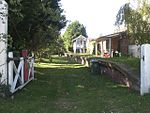
All Saints Church, Fring geograph.org.uk 1163005

Fring is a civil parish in the English county of Norfolk. It covers an area of 6.93 km2 (2.68 sq mi) and had a population of 94 in 41 households at the 2001 census. The population remained less than 100 at the 2011 Census and was included in the civil parish of Sedgeford. For the purposes of local government, it falls within the district of King's Lynn and West Norfolk. There is a small cluster of buildings located along Fring road consisting of Fring All Saints. The villages name means 'Frea's place'. In 1870–72 Fring was described as: "a parish in Docking district, Norfolk; 2¾ miles SW of Docking, and 2 ESE of Sedgeford r. station. Post town, Docking, under Lynn. Acres, 1,710. Real property, £2,065. Pop., 173. Houses, 37." Fring is the traditional source of the River Heacham and a (now) often dry lake bed of approximately one acre marks the point where a spring fed the river. (52°52'56.0"N 0°34'48.4"E).

Excerpt from the Wikipedia article Fring, Norfolk (License: CC BY-SA 3.0, Authors, Images).

Fring, Norfolk
Bircham Road, King's Lynn and West Norfolk Fring

Geographical coordinates (GPS) Address Nearby Places
placeShow on map

Wikipedia: Fring, NorfolkContinue reading on Wikipedia

Geographical coordinates (GPS)

Latitude Longitude
N 52.881562 ° E 0.581074 °
placeShow on map

Address

Bircham Road

Bircham Road
PE31 6SH King's Lynn and West Norfolk, Fring
England, United Kingdom
mapOpen on Google Maps

All Saints Church, Fring geograph.org.uk 1163005
Share experience

Nearby Places

Anmer
Anmer

Anmer is a small village and civil parish in the English county of Norfolk. It is around 12 miles (19 km) north-east of the town of King's Lynn and 35 miles (56 km) north-west of the city of Norwich. The parish is in the district of King's Lynn and West Norfolk and at the 2001 census had a population of 63 in 29 households. The place-name 'Anmer' is recorded in the Domesday Book of 1086, where it appears as Anemere. This name derives from the Old English aened-mere, meaning 'duck mere or lake'. The parish contains evidence of settlement from the Bronze Age onwards, with a number of Bronze Age barrows to the east of the village.Anmer Hall, the former residence of the Duke and Duchess of Kent, dates from the 18th century and stands at the centre of a landscape park laid out in 1793. This led to the clearance of the original medieval settlement and its relocation to the north-west of the hall, creating the modern village. This involved the closure of all roads across the park. A number of earthworks, including a two-metre-deep hollow way, are preserved at the site of the medieval village.The hall is located west of the village and is linked to the nearby Sandringham estate by a long straight road known as ‘The Avenue’. In 2014 it was renovated as the new country home of the then Duke and Duchess of Cambridge. The parish church, which is dedicated to St Mary, is on the Anmer Hall estate. A Grade II* listed building, it was restored in the 19th century.