place

Terrington St John

Civil parishes in NorfolkKing's Lynn and West NorfolkNorfolk geography stubsVillages in Norfolk

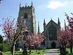
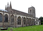
Terrington St John is a village and civil parish in the English county of Norfolk. The village lies to the south of the route of the A47 between Peterborough and Kings Lynn. It covers an area of 8.26 km2 (3.19 sq mi) and had a population of 882 in 336 households at the 2001 census, the population slightly increasing to 891 at the 2011 Census. For the purposes of local government, it falls within the district of King's Lynn and West Norfolk. The Church of St John is a Grade I listed building.

Excerpt from the Wikipedia article Terrington St John (License: CC BY-SA 3.0, Authors).

Terrington St John
School Road, King's Lynn and West Norfolk Terrington St. John

Geographical coordinates (GPS) Address Nearby Places
placeShow on map

Wikipedia: Terrington St JohnContinue reading on Wikipedia

Geographical coordinates (GPS)

Latitude Longitude
N 52.70226 ° E 0.27352 °
placeShow on map

Address

School Road

School Road
PE14 7RR King's Lynn and West Norfolk, Terrington St. John
England, United Kingdom
mapOpen on Google Maps

Share experience

Nearby Places

Marshland St James
Marshland St James

Marshland St James is a village and civil parish in the English county of Norfolk. It covers an area of 25.69 km2 (9.92 sq mi) and had a population of 1,137 in 456 households at the 2001 census, increasing to 1,209 at the 2011 Census. For the purposes of local government, it falls within the district of King's Lynn and West Norfolk. Churches Marshland St James had multiple churches which are Anglican and Methodist. The parish church is St James in the deanery of Lynn Marshland, in the archdeaconry of Wisbech. The original Church of England church was St Jame. It was founded in 1837 and closed in 2002. The church did not have a graveyard. The church does not have a graveyard. Marshland Fen Methodist Church was founded before 1907. The Primitive Methodist church was an early 19th century (1807) secession from the Wesleyan Methodist church and was particularly successful in evangelising agricultural and industrial communities at open meetings. In 1932 the Primitive Methodists joined with the Wesleyan Methodists and the United Methodists to form the Methodist Church of Great Britain. Historical geography Marshland St James is about 11 miles S.W. of King's Lynn. It was created as an ecclesiastical parish in 1922, and as a civil parish in 1935, from parts of Clenchwarton, Emneth, Terrington St Clement, Terrington St John, Tilney All Saints, Tilney St Lawrence, Tilney cum Islington, Walpole St Andrew, Walpole St Peter, and West Walton. [from Kelly's Directory of Norfolk 1937] Marshland St James is in Freebridge Marshland hundred.