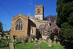
Swalcliffe
1983 disasters in the United KingdomAviation accidents and incidents locations in EnglandCivil parishes in OxfordshireUse British English from August 2015Villages in Oxfordshire

Swalcliffe is a village and civil parish about 5 miles (8 km) west of Banbury in Oxfordshire. The parish is about 2+1⁄2 miles (4 km) long north–south and about 1 mile (1.6 km) east–west. The 2011 Census recorded the population of the modern Swalcliffe parish as 210. The toponym "Swalcliffe" comes from the Old English swealwe and clif, meaning a slope or cliff frequented by swallows. The ancient parish of Swalcliffe was larger than the present civil parish, and included the townships of East Shutford, Epwell, Sibford Ferris, Sibford Gower and West Shutford.
Excerpt from the Wikipedia article Swalcliffe (License: CC BY-SA 3.0, Authors, Images).Swalcliffe
Park Lane, Cherwell District Swalcliffe
Geographical coordinates (GPS) Address Phone number Website Nearby Places Show on map
Geographical coordinates (GPS)
| Latitude | Longitude |
|---|---|
| N 52.038 ° | E -1.452 ° |
Address
Swalcliffe Park School CIO
Park Lane
OX15 5EP Cherwell District, Swalcliffe
England, United Kingdom
Open on Google Maps


