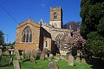
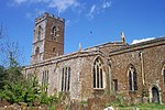
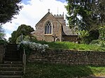
Shutford

Shutford is a village and civil parish about 4.5 miles (7.2 km) west of Banbury in Oxfordshire. The village is about 475 feet (145 m) above sea level. In 1870–72, John Marius Wilson's Imperial Gazetteer of England and Wales described Shutford like this: "SHUTFORD, a chapelry in Swalcliffe parish, Oxford; 5 miles W of Banbury r. station. It has a postal pillar-box under Banbury. Acres, 640. Real property, £2,840. Pop., 386. Houses, 98. The living is annexed to Swalcliffe. The church was repaired in 1841. There are chapels for Wesleyans and Primitive Methodists."The name Shutford is derived from Scytta's Ford. In the fourteenth century the village was quite large. 20 people were assessed for tax in 1327. In 1377 there were 86. A fire in 1701 destroyed 24 houses. Some houses were rebuilt and modernised. In 1774 71 houses were recorded. In the Middle Ages there were 3 manors in Shutford. The manor house appears to have been built in the 16th century. In the Civil War, Viscount Saye and Sele supported the Parliamentarians. Plush and shag weaving was established in 1747 and became the village's main claim to fame.
Excerpt from the Wikipedia article Shutford (License: CC BY-SA 3.0, Authors, Images).Shutford
Ivy Lane, Cherwell District Shutford
Geographical coordinates (GPS) Address Nearby Places Show on map
Geographical coordinates (GPS)
| Latitude | Longitude |
|---|---|
| N 52.06 ° | E -1.438 ° |
Address
Ivy Lane
Ivy Lane
OX15 6PD Cherwell District, Shutford
England, United Kingdom
Open on Google Maps


