Tugby and Keythorpe

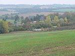
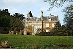
Tugby and Keythorpe is a civil parish comprising the village of Tugby and land surrounding Keythorpe Hall, Hall Farm and Lodge Farm in Leicestershire, England, part of the Harborough district. The Parish covers around 2,200 acres, situated 7 miles west of Uppingham, and 12 miles east of Leicester. According to the 2011 census the population of the parish was 330. The Anglican parish register for the parish dates back to 1568. The boundaries of the parish have not changed throughout the years, meaning that the parish's size remains the same as it did in 1568. In the 1887 Gazetter of the British Isles it is suggested that the town dates back to Norman rule stating: "The church has a Norman tower, and is good."
Excerpt from the Wikipedia article Tugby and Keythorpe (License: CC BY-SA 3.0, Authors, Images).Tugby and Keythorpe
Uppingham Road, Harborough Tugby and Keythorpe
Geographical coordinates (GPS) Address Nearby Places Show on map
Geographical coordinates (GPS)
| Latitude | Longitude |
|---|---|
| N 52.60315 ° | E -0.86672 ° |
Address
Uppingham Road
Uppingham Road
LE7 9WU Harborough, Tugby and Keythorpe
England, United Kingdom
Open on Google Maps


