place

Mill Road, Cambridge

History of CambridgeHughes Hall, CambridgeShopping streets in CambridgeUse British English from December 2017
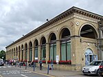
Mill Road, Cambridge, England in 2007

Mill Road is a street in southeast Cambridge, England. It runs southeast from near to Parker's Piece, at the junction with Gonville Place, East Road, and Parkside. It crosses the main railway line and links to the city's ring road (the A1134). It passes through the wards of Petersfield and Romsey, which are divided by the railway line. It is a busy street containing many independent businesses, churches, a Hindu temple and Cambridge Central Mosque. Near the northwestern end to the south in Mortimer Road off Mill Road is Hughes Hall. Behind Hughes Hall is Fenner's, the cricket ground of the University of Cambridge, which has hosted first-class cricket since 1848. To the north is Anglia Ruskin University, formerly Cambridgeshire College of Arts and Technology (CCAT).

Excerpt from the Wikipedia article Mill Road, Cambridge (License: CC BY-SA 3.0, Authors, Images).

Mill Road, Cambridge
Mill Road, Cambridge Petersfield

Geographical coordinates (GPS) Address Phone number Nearby Places
placeShow on map

Wikipedia: Mill Road, CambridgeContinue reading on Wikipedia

Geographical coordinates (GPS)

Latitude Longitude
N 52.1999 ° E 0.1376 °
placeShow on map

Address

Pizza Hut Delivery

Mill Road 83
CB1 2AW Cambridge, Petersfield
England, United Kingdom
mapOpen on Google Maps

Phone number

call+441223300005

Mill Road, Cambridge, England in 2007
Share experience

Nearby Places

Mill Road Cemetery, Cambridge

Mill Road Cemetery is a cemetery off Mill Road in the Petersfield area of Cambridge, England. Since 2001 the cemetery has been protected as a Grade II Listed site, and several of the tombs are also listed as of special architectural and historical interest.The cemetery was established in 1848 on a site formerly occupied by a cricket ground, as a collection of burial grounds for 13 city parishes (now 10 through amalgamation) whose churchyards had become full. A chapel built by George Gilbert Scott was demolished in 1954. An outline of the chapel in carved stone was completed in 2017 as a record and memorial, made possible by the National Lottery Heritage Fund. All the plots are now closed for burials, and the cemetery as a whole is by law maintained by the City Council and managed on behalf of the parishes by the Parochial Burial Grounds Management Committee. The Commonwealth War Graves Commission maintain the graves of 33 Commonwealth service personnel from World War I and 4 from World War II.The cemetery can be accessed from Mill Road, from Norfolk Street, or through the industrial estate on Gwydir Street. In February 2014 an art work entitled Bird Stones by Gordon Young was installed in the cemetery. Its one wooden and six stone columns celebrate the bird species found in the cemetery and their birdsong.The cemetery is also listed as a City Wildlife Site, containing many indicator plant species for undisturbed neutral/calcareous grassland amongst the 110+ species identified. At least 35 species of bird, 23 species of butterflies and several species of mammal have also been reported, including the European dormouse and weasel.