Nantlle Valley

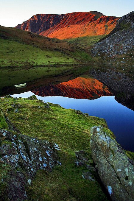
The Nantlle Valley (Welsh: Dyffryn Nantlle, IPA: [ˈdəfrɨn ˈnantɬɛ]) is an area in Gwynedd, North Wales, characterised by its numerous small settlements. The area is also historically important geologically, and featured in one of the most contentious disputes of the 19th century, between the 'Diluvialists' who believed in the Biblical flood, and the ‘Glacialists’, who supported the Glacial Theory, which was substantially established by studies of the drift sediments on Moel Tryfan.Between 85 and 90% of the population of the Nantlle Valley speak Welsh as their first language.Some of the communities came into being as a result of slate quarrying in the late eighteenth or early nineteenth centuries, and some have a history stretching back to antiquity. There are Iron Age forts at Caer Engan in Pen-y-groes and on the coast at Dinas Dinlle and evidence of Bronze Age settlement on the higher ground. The valley was important during the Middle Ages, with a clas or ecclesiastical college developed at Clynnog Fawr.The Glynllifon estate can trace its foundation historically to the 8th century and there is evidence of occupation on the site going back to the Iron Age.There were a number of quarries in the valley, the largest being the Dorothea and Pen yr Orsedd quarries. Although the major quarries are worked out, there remains demand for slate waste for garden decoration.In 1991, Antur Nantlle Cyf was established as a community enterprise to work for the benefit of the Nantlle Valley and its surrounding area.
Excerpt from the Wikipedia article Nantlle Valley (License: CC BY-SA 3.0, Authors, Images).Nantlle Valley
Ffordd y Parc,
Geographical coordinates (GPS) Address Nearby Places Show on map
Geographical coordinates (GPS)
| Latitude | Longitude |
|---|---|
| N 53.025 ° | E -4.2833333333333 ° |
Address
Ffordd y Parc
Ffordd y Parc
LL54 6DP , Llanllyfni
Wales, United Kingdom
Open on Google Maps


