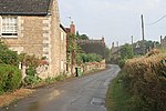
Glaston

Glaston is a village in the county of Rutland in the East Midlands of England. The population of the civil parish remained unchanged between the 2001 and the 2011 censuses. The village's name means 'farm/settlement of Glathr'.Glaston is about 4 miles (6.4 kilometres) south of Rutland Water and is situated on the A47, 2 miles (3.2 kilometres) east of Uppingham. There are approximately 80 houses in total with one public house, The Old Pheasant (previously the Monckton Arms) on Main Road (A47), and a flooring warehouse, Glaston Carpets. There is an active parish meeting that is held once a month and villagers are trying to get a bypass for the village. A rectangular pond is a cartwash of circa 1740, used for soaking cartwheels to prevent the wood shrinking from iron tyres and also for horses' hooves to prevent hardening.Glaston railway tunnel, 1 mile 82 yards in length, is located within the parish, to the east of the village.
Excerpt from the Wikipedia article Glaston (License: CC BY-SA 3.0, Authors, Images).Glaston
Church Lane,
Geographical coordinates (GPS) Address Nearby Places Show on map
Geographical coordinates (GPS)
| Latitude | Longitude |
|---|---|
| N 52.595 ° | E -0.678 ° |
Address
Church Lane
LE15 9BU
England, United Kingdom
Open on Google Maps


