Canton River (United States)
Massachusetts river stubsNorfolk County, Massachusetts geography stubsRivers of MassachusettsRivers of Norfolk County, Massachusetts
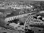
The Canton River passes through downtown Canton, Massachusetts, tracing down Washington and Neponset Streets (flowing under the Canton Viaduct), and continues down Walpole Street. It is a tributary of the Neponset River, with a few tributaries on the side. It is also called the East Branch [of the] Neponset River.
Excerpt from the Wikipedia article Canton River (United States) (License: CC BY-SA 3.0, Authors).Canton River (United States)
Crisileo Way,
Geographical coordinates (GPS) Address Nearby Places Show on map
Geographical coordinates (GPS)
| Latitude | Longitude |
|---|---|
| N 42.1576 ° | E -71.1631 ° |
Address
Canton River Land
Crisileo Way
02021
Massachusetts, United States
Open on Google Maps


