place

Lasham

Villages in Hampshire
St Marys Parish Church, Lasham, Hampshire 12Oct2009

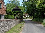
Lasham is a village and civil parish in the East Hampshire district of Hampshire, England. It is 3.4 miles (5.5 km) northwest of Alton and 1.2 miles (1.9 km) north of Bentworth, just off the A339 road. The parish covers an area of 1,797 acres (727 ha) and has an average elevation of 560 feet (170 m) above sea level. The nearest railway station is Alton, 3.5 miles (5.6 km) southeast of the village. Lasham formerly had its own railway station, Bentworth and Lasham, on the Basingstoke and Alton Light Railway until the line's closure in 1936. According to the 2011 census, the village had a population of 176.

Excerpt from the Wikipedia article Lasham (License: CC BY-SA 3.0, Authors, Images).

Lasham
Lasham Road, East Hampshire

Geographical coordinates (GPS) Address Nearby Places
placeShow on map

Wikipedia: LashamContinue reading on Wikipedia

Geographical coordinates (GPS)

Latitude Longitude
N 51.17677 ° E -1.033553 °
placeShow on map

Address

Lasham Road
GU34 5SG East Hampshire
England, United Kingdom
mapOpen on Google Maps

St Marys Parish Church, Lasham, Hampshire 12Oct2009
Share experience

Nearby Places

Bentworth
Bentworth

Bentworth is a village and civil parish in the East Hampshire district of Hampshire, England. The nearest town is Alton, which lies about 3 miles (5 km) east of the village. It sits within the East Hampshire Hangers, an area of rolling valleys and high downland. The parish covers an area of 3,763 acres (15.23 km2) and at its highest point is the prominent King's Hill, 716 feet (218 m) above sea level. According to the 2011 census, Bentworth had a population of 553.The village has a long history, as shown by the number and range of its heritage-listed buildings. Bronze Age and Roman remains have been found in the area and there is evidence of an Anglo-Saxon church in the village. The manor of Bentworth was not named in the Domesday Book of 1086, but it was part of the Odiham Hundred. Land ownership of the village was passed by several English kings until the late Elizabethan era. During the Second World War, Bentworth Hall was requisitioned as an outstation for the Royal Navy and nearby Thedden Grange was used as a prisoner of war camp. Parts of the village were designated a conservation area in 1982. The parish contains several manors including Bentworth Hall, Hall Place, Burkham House, Wivelrod Manor, Gaston Grange and Thedden Grange. The 500-acre (2.0 km2) estate of Bentworth Hall was split up as a result of various sales from the 1950s. St Mary's Church, a Grade II* listed building which parts of which date back to the late 11th century, lies at the centre of the village. The village has two public houses, the Star Inn and the Sun Inn; a primary school; and its own cricket club. Bentworth formerly had a railway station, Bentworth and Lasham, on the Basingstoke and Alton Light Railway until the line's closure in 1936. The nearest railway station is now 3.8 miles (6.1 km) east of the village, at Alton.