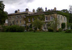
Shalden

Shalden is a village and civil parish in the East Hampshire district of Hampshire, England. It is 2.3 miles (3.7 km) northwest of Alton and 1.9 miles (3.1 km) northeast of Bentworth, just off the A339 road. The parish covers an area of 1,536 acres (622 ha) and has an average elevation of 600 feet (180 m) above sea level. The nearest railway station is Alton, 2.5 miles (4.0 km) southeast of the village. According to the 2011 census, it had a population of 435. Bronze Age and Roman remains have been found in the area. The manor of Shalden was recorded in the Domesday Survey of 1086, and was included in the Odiham Hundred. A Saxon church was in the village, but was destroyed and replaced with a newer church, which was constructed in 1863. The village contains twelve Grade II listed landmarks, including St Peter and St Paul's church, Shalden Lodge and Manor Farmhouse, a Grade II* listed building.
Excerpt from the Wikipedia article Shalden (License: CC BY-SA 3.0, Authors, Images).Shalden
Shalden Lane, East Hampshire Shalden
Geographical coordinates (GPS) Address Nearby Places Show on map
Geographical coordinates (GPS)
| Latitude | Longitude |
|---|---|
| N 51.17359 ° | E -1.00543 ° |
Address
Manor Farm
Shalden Lane
GU34 4DU East Hampshire, Shalden
England, United Kingdom
Open on Google Maps


