Braceborough and Wilsthorpe
Civil parishes in LincolnshireSouth Kesteven DistrictUse British English from March 2014

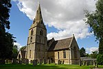
Braceborough and Wilsthorpe is a civil parish in the South Kesteven district of Lincolnshire, England. Braceborough and Wilsthorpe are less than 1 mile (1.6 km) apart, separated by the East Glen River. Braceborough and Wilsthorpe are located between the A6121 road, which goes from Stamford to Bourne, and the A15, this links Bourne and Market Deeping. It is approximately 12 miles (19 km) north-west from its nearest city, Peterborough. Before the 1930s Braceborough and Wilsthorpe were separate parishes but in 1931 the two were dissolved and joined together to form today's civil parish.
Excerpt from the Wikipedia article Braceborough and Wilsthorpe (License: CC BY-SA 3.0, Authors, Images).Braceborough and Wilsthorpe
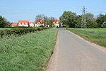
Braceborough Road, South Kesteven Braceborough and Wilsthorpe
Geographical coordinates (GPS) Address Nearby Places Show on map
Geographical coordinates (GPS)
| Latitude | Longitude |
|---|---|
| N 52.71 ° | E -0.39 ° |
Address
Braceborough Road
Braceborough Road
PE9 4PB South Kesteven, Braceborough and Wilsthorpe
England, United Kingdom
Open on Google Maps


