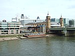
Cannon Street station

Cannon Street station, also known as London Cannon Street, is a central London railway terminus and connected London Underground station in Travelcard zone 1 located on Cannon Street in the City of London and managed by Network Rail. It is one of two London termini of the South Eastern Main Line, the other being Charing Cross, while the Underground station is on the Circle and District lines, between Monument and Mansion House. The station runs services by Southeastern, mostly catering for commuters in southeast London and Kent, with occasional services further into the latter. The station was built on a site of the medieval steelyard, the trading base in England of the Hanseatic League. It was built by the South Eastern Railway in order to have a railway terminal in the City and compete with the rival London, Chatham and Dover Railway. This required a new bridge across the River Thames, which was constructed between 1863 and 1866. The station was initially a stop for continental services from Charing Cross, and that route was convenient for travel between the City and the West End, until the construction of the District Railway. It remained popular with commuters, though its off-peak services were discontinued in the early 20th century, leading to it being closed on Sundays for almost 100 years. The original hotel on the station was unsuccessful, and eventually closed. The station was controversially renovated in the late 1950s by John Poulson, while further construction on top of the station building occurred during the City's 1980s property boom. The Poulson building was replaced in 2007 as part of a general renovation of the station to make it more accessible. As part of the Thameslink Programme development in the 2010s, it was re-opened on Sundays and began to offer more long-distance services in place of Charing Cross.
Excerpt from the Wikipedia article Cannon Street station (License: CC BY-SA 3.0, Authors, Images).Cannon Street station
Upper Thames Street, City of London
Geographical coordinates (GPS) Address Nearby Places Show on map
Geographical coordinates (GPS)
| Latitude | Longitude |
|---|---|
| N 51.5104 ° | E -0.0907 ° |
Address
Upper Thames Street
Upper Thames Street
EC4R 3UL City of London
England, United Kingdom
Open on Google Maps


