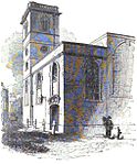
Coldharbour, City of London
1666 disestablishmentsBuildings and structures in the City of LondonFormer buildings and structures in the City of LondonFormer houses in the City of LondonHistory of London by locality ... and 2 more
History of the City of LondonLiberties of London

Coldharbour, also spelled Cold Harbour, Cold Harborough, Cold Herbergh, Cold Herberge, and Cold Inn, were two London neighbouring estates in the since dissolved parishes of All-Hallows-the-Less and All-Hallows-the-Great, in today's Dowgate Ward of the City of London. From the 13th century to the mid-17th century Coldharbour occupied the area between Upper Thames Street and the Thames to the east of Cannon Street station. It was destroyed in the Great Fire of 1666. One of the estates was used by the Dukes of Exeter and briefly as a college of heralds.
Excerpt from the Wikipedia article Coldharbour, City of London (License: CC BY-SA 3.0, Authors, Images).Coldharbour, City of London
Angel Lane, City of London
Geographical coordinates (GPS) Address Nearby Places Show on map
Geographical coordinates (GPS)
| Latitude | Longitude |
|---|---|
| N 51.51 ° | E -0.09 ° |
Address
Nomura International
Angel Lane 1
EC4R 3AB City of London
England, United Kingdom
Open on Google Maps


