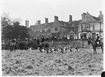
Horringer
Borough of St EdmundsburyCivil parishes in SuffolkHorringerUse British English from January 2021Villages in Suffolk

Horringer, formerly also called Horningsheath, is a village and civil parish in the West Suffolk district of Suffolk in eastern England. It lies on the A143 about two miles south-west of Bury St Edmunds. The population in 2011 was 1055.
Excerpt from the Wikipedia article Horringer (License: CC BY-SA 3.0, Authors, Images).Horringer
Meadow Drive, West Suffolk
Geographical coordinates (GPS) Address Nearby Places Show on map
Geographical coordinates (GPS)
| Latitude | Longitude |
|---|---|
| N 52.223 ° | E 0.673 ° |
Address
Meadow Drive 7
IP29 5SB West Suffolk
England, United Kingdom
Open on Google Maps


