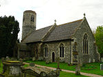
Palgrave, Suffolk
Civil parishes in SuffolkEngvarB from July 2016Mid Suffolk DistrictVillages in Suffolk

Palgrave is a village and civil parish in the Mid Suffolk district of Suffolk in eastern England. It is located on the south bank of the River Waveney, opposite Diss in Norfolk and adjacent to the Great Eastern Main Line. Palgrave has a small primary school, with St Peter’s Church located opposite, and is situated approximately 1 mile from Diss. It also has a green, park, pond, and cemetery. Palgrave had a population of 905 people in 366 households, according to the 2011 Census.Palgrave shares a significant historical link with its West/East road linking Great Yarmouth in Norfolk and Bury St Edmunds in Suffolk in the Domesday period (circa 1086).
Excerpt from the Wikipedia article Palgrave, Suffolk (License: CC BY-SA 3.0, Authors, Images).Palgrave, Suffolk
Coleman Close,
Geographical coordinates (GPS) Address Nearby Places Show on map
Geographical coordinates (GPS)
| Latitude | Longitude |
|---|---|
| N 52.36298 ° | E 1.10756 ° |
Address
Coleman Close 6
IP22 1TH
England, United Kingdom
Open on Google Maps


