Scole

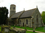
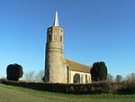
Scole () is a village on the Norfolk–Suffolk border in England. It is 19 miles south of Norwich and lay on the old Roman road to Venta Icenorum, which was the main road until it was bypassed with a dual carriageway. It covers an area of 14.31 km2 (5.53 sq mi) and had a population of 1,339 in 563 households at the 2001 census; the population had increased to 1,367 at the 2011 Census.It lies on the north bank of the River Waveney. The parish church of St Andrew was rebuilt in the 1960s after being destroyed in an arson attack. There is an east window by Patrick Reyntiens dating from 1963.Scole is the birthplace of William Gooderham (1792) and Ezekiel Gooderham (1794), founders of the Gooderham and Worts distillery in Toronto, Canada, later to be the largest in the British Empire.
Excerpt from the Wikipedia article Scole (License: CC BY-SA 3.0, Authors, Images).Scole
The Street,
Geographical coordinates (GPS) Address Phone number Website Nearby Places Show on map
Geographical coordinates (GPS)
| Latitude | Longitude |
|---|---|
| N 52.366 ° | E 1.156 ° |
Address
Diss by Verve
The Street
IP21 4DR , Scole
England, United Kingdom
Open on Google Maps


