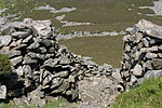
A499 road
Geographic coordinate listsInfobox road instances in WalesInfobox road maps tracking categoryLists of coordinatesRoads in Gwynedd ... and 3 more
United Kingdom road stubsUse British English from February 2013Wales stubs

The A499 road is the major road of the Llŷn peninsula in North Wales. Its northern terminus is a roundabout with the A487 trunk road between Llanwnda and Llandwrog (53.0948°N 4.2824°W / 53.0948; -4.2824 (A499 road (northern end))). It then runs south-westerly along the northern coast of the peninsula, through Clynnog Fawr then turns inland crossing the peninsula to meet the southern coast at Pwllheli, it then follows that southern coast to terminate at Abersoch (52.8227°N 4.5054°W / 52.8227; -4.5054 (A499 road (southern end))). The total length is 23.4 miles. At no point is it a trunk road, although the Welsh Assembly has considered upgrading its status.
Excerpt from the Wikipedia article A499 road (License: CC BY-SA 3.0, Authors, Images).A499 road
A499,
Geographical coordinates (GPS) Address Nearby Places Show on map
Geographical coordinates (GPS)
| Latitude | Longitude |
|---|---|
| N 52.9711 ° | E -4.4009 ° |
Address
A499
LL54 5AG , Llanaelhaearn
Wales, United Kingdom
Open on Google Maps


