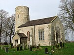
Mattishall
Breckland DistrictCivil parishes in NorfolkEngvarB from June 2016Villages in Norfolk

Mattishall is a village and civil parish in the English county of Norfolk. It is situated 13 miles (21 km) west of Norwich and 4 miles (6.4 km) east of Dereham, at the geographical centre of Norfolk. It covers an area of 11.89 km2 (4.59 sq mi) and had a population of 2,631 in 1,110 households at the 2001 census. For the purposes of local government, it falls within the Elmham and Mattishall division of Norfolk County Council and the Mattishall ward of Breckland District Council. It is in the Mid Norfolk Parliamentary Constituency.
Excerpt from the Wikipedia article Mattishall (License: CC BY-SA 3.0, Authors, Images).Mattishall
Dereham Road, Breckland District
Geographical coordinates (GPS) Address Website Nearby Places Show on map
Geographical coordinates (GPS)
| Latitude | Longitude |
|---|---|
| N 52.6585 ° | E 1.03466 ° |
Address
All Saints
Dereham Road
NR20 3QB Breckland District
England, United Kingdom
Open on Google Maps


